Sonder-Magnetiksystem der RGK beim Einsatz in Musov © DAI + RGK // Roman Scholz (RGK)
Unit for Survey and Excavation Methodology
Profile
The Unit for Survey and Excavation Methodology (Referat für Prospektions- und Grabungsmethodik, RefPGM), founded in 2010 and initially known as the Technische Abteilung, is a central research hub at the RGK. The unit's and laboratory's scientific management including two excavation technicians, one laboratory technician, and several scientific and student assistants provide, maintain, and develop processes and infrastructures, without which particularly fieldwork, but also many of the analyses and digital evaluations and representations of geo-data, archaeological objects, samples and drill cores would be unthinkable.
From satellite-based remote sensing to geophysical prospection and excavation to object investigation, the unit's staff supervises and accompanies the work of the RGK. The RefPGM moreover develops and implements methods for processing and archiving the data generated both in the field and in the laboratory. This is done in close coordination with other departments of the German Archaeological Institute, in particular those concerning the natural sciences and information technology.
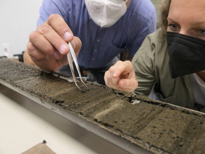
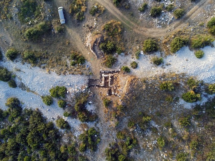
Of special significance is the RefPGM's work on the continuous development of minimally invasive archaeological approaches. They make it possible to obtain as much information as possible from archaeological sites without destroying them. The RefPGM has considerable capacities in remote sensing and geophysical prospecting. Drilling and drill core analyses contribute to the systematic expansion of the soils archive, even through innovative pilot projects with the commission's cooperation partners. The excavations are supplemented with advice and assistance from the technical staff to ensure the state of the highest methodological and technical standards in both terrestrial and aquatic environments. The RefPGM laboratory takes and analyses samples of a wide range of materials. Emphasis is placed on the determination of chemical composition by RFA/XRF and the examination of traces of usewear and processing by digital microscopy. An important area of current research is the development of standards for the collection and archiving of archaeological soil samples, not least with regard to the analysis of sedimentary DNA and other biomarkers.
From the very large to the very small, the unit is in some form involved in virtually all RGK research projects. It participates in the further development and communication of archaeological research methods and practices.
History and Development of the Unit
In the course of the large-scale excavations of the RGK at the Celtic oppidum of Manching, the RGK maintained a branch office in Ingolstadt, where under the direction of Franz Schubert, an outstanding technical infrastructure for field research was created. In addition, new methods and recording techniques were systematically tested and improved at Manching. These included the electromagnetic investigations by C. Colani in 1974 and 1975 and the use of a computer-aided 3D pantograph in the 1990s.
This prompted Claus-Michael Hüssen, responsible for the branch office at Manching, to set up a 'technical department' in Frankfurt in 2009 to accompany the field research of the entire RGK, before Knut Rassmann took over the management of the unit in 2011. In 2021, it was officially renamed to Referat für Prospektions- und Grabungsmethodik.
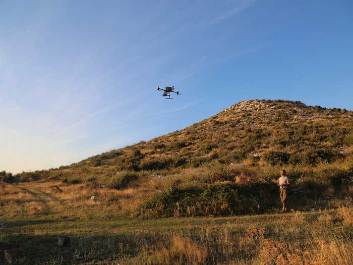
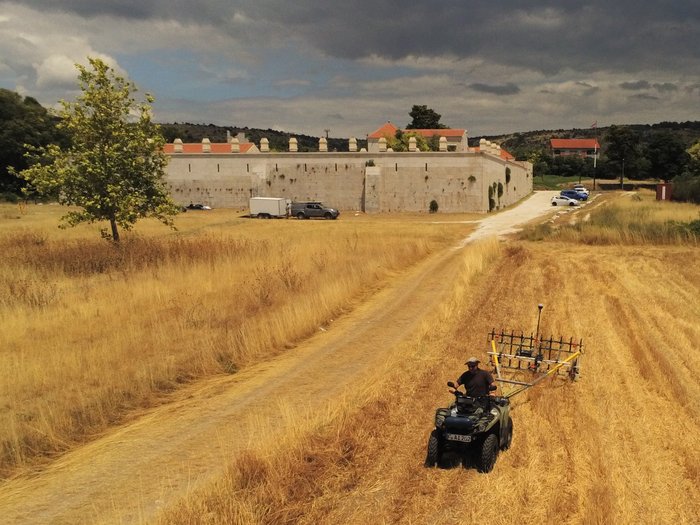
Excavations of the RGK have been and continue to be supported by the unit. Magnetic prospection has also been carried out in many regions of Europe and is one of the unit's core methods. Since its creation, the unit's capacities for prospecting, excavating and analysing soil samples and finds has been expanding progressively. In the meantime, the laboratory and sample archive have evolved to another central component of the unit's work. Recently, the foundations for unmanned aerial vehicle (UAV) prospecting have also been developed. In addition to conventional RGB images, multi-spectral and thermal sensors are used, as well as UAV-based Lidar scans. In combination, the unit's various technical platforms enable integrated survey concepts at all spatial scales.
The technical unit's emphasis is on closely connecting archaeological issues and corresponding methods of prospection, field research, and recording techniques. We try to bridge the gap between dynamic method development and archaeological practice and to make our knowledge and experience available for colleagues also beyond the RGK and the DAI. For this we set up forums and platforms such as the work group 'Landscape Archaeology at the DAI' (Landschaftsarchäologie am DAI )(Link) or the idai.world and promote the transfer of methods with our European partner countries and institutions.