Modern Field and Laboratory Research
Small sherds and large works of art, discolourations in the ground, monumental structures or an ancient DNA sequence - they all provide information about the lives of past people. As diverse as these sources of the past are the disciplines and scientific methods used to study them.
Modern prospecting methods, from satellite-based remote sensing to geophysical subsurface surveys, allow us to gather a wide range of information about sites without having to dig in the ground.
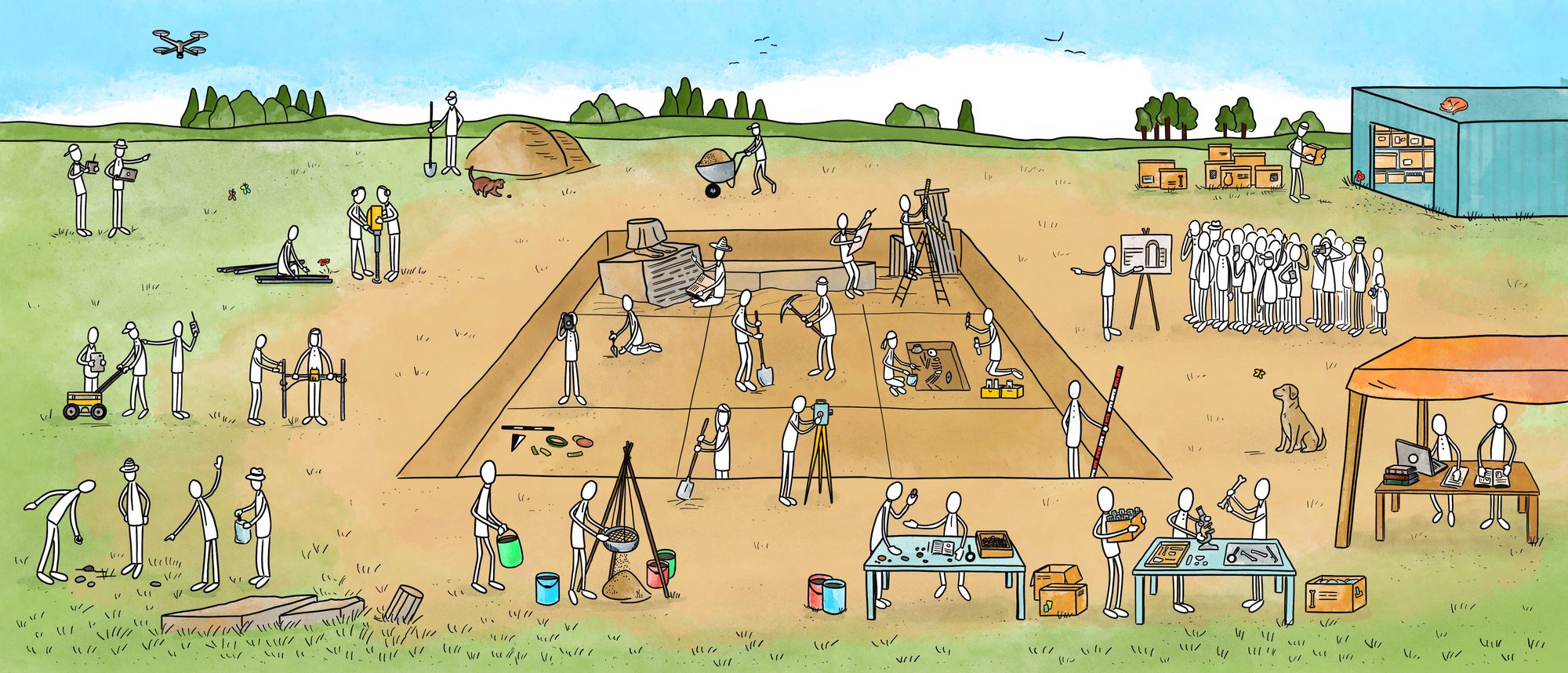
New technologies have also entered everyday excavation. Digital documentation methods have become an integral part of the archaeological toolkit alongside shovel, trowel, brush, as well as an extensive range of modern analytical methods for the post-excavation study of finds or features.
© DAI // Jens Notroff
Exploration
A prerequisite for in-depth archaeological investigations is the identification of relevant traces and sites of past life. Modern archaeology has a range of non-invasive or minimally invasive methods at its disposal. These methods must be applied before the first sod is turned, in order to minimise the impact on the archaeological site.
In addition to site inspection and systematic documentation of surface finds, geophysical prospection methods are playing an increasingly important role. They make it possible, for example, to map previous ground disturbances by measuring electrical ground resistance or geomagnetic anomalies. Test borings and exploratory excavations provide further insight into the subsurface and can help to identify potential sites or interesting finds at depth.
Laser-assisted surveying methods such as LiDAR help to locate ruins even if they are hidden under dense jungle, and when aerial photographs are analysed, vegetation features can provide clues to possible archaeological structures below ground. The use of remotely piloted multi-copters makes it possible to fly over and document even small study areas at low altitudes, while satellite imagery provides a view of even larger areas.
Excavation and Documentation
While modern survey methods can provide a picture of archaeological remains below the surface without disturbing the ground, only excavation can reveal the full diversity of features and finds present there. They provide important information for dating and cultural-historical classification of the site.
As every excavation represents an intervention in the strata of the ground, the precise documentation of all work steps is an important prerequisite for the subsequent reconstruction of the respective find contexts. The DAI has a wide range of interdisciplinary expertise available for the analysis of finds and features. This includes building research. In addition to traditional documentation methods such as scale drawings and photography, digital methods such as 3D laser scanning and structure-from-motion photogrammetry are also used.
Analysis
We collaborate and exchange ideas with many international partners. Overarching issues are discussed in research clusters at the DAI and in large research networks. This is the only way that complex pictures can be drawn and changes can be described.
Geoscientists study changes in the landscape. Bone, plant remains and soil samples are examined by archaeozoologists, archaeobotanists and many other specialist scientific disciplines in the laboratories of the DAI and cooperating institutions. In addition to scientific sources, written and pictorial sources from past epochs are also used. The results are then used as the basis for digital analysis and modelling.
Digital Methods
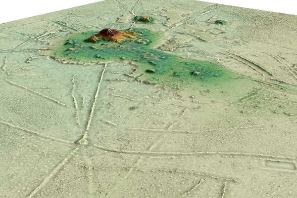
Computergeneriertes 3D-Geländemodell auf Grundlage eines LiDAR-Scans, in dem unter dichter Vegetation im nördlichen Tiefland von Bolivien Graben-Wall-Anlagen und auf Dämmen verlaufende Wege deutlich auszumachen sind. © DAI // H. Prümers
LiDAR
Non-invasive methods provide fundamental insight into the location and extent of possible archaeological remains, such as LiDAR (Light Detection and Ranging) to create digital terrain models, or digital mapping of ground features through geophysical measurements and computer-aided analysis of aerial and satellite imagery.
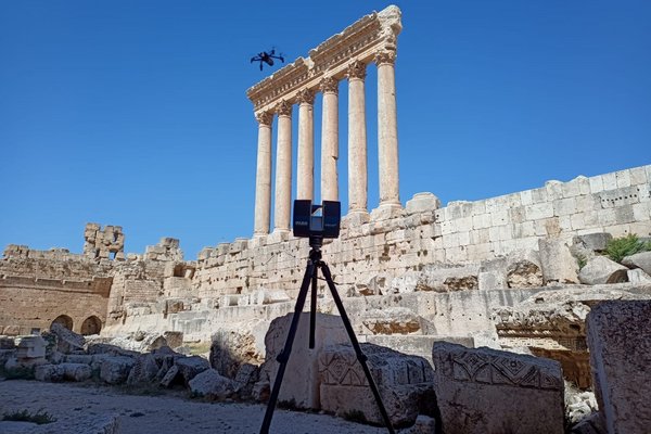
Dokumentation der archäologischen Stätten Baalbek, Libanon, mit Laserscans und Luftbildern. © DAI, Orient-Abteilung // M. Praus
Photogrammetry
Modern imaging techniques, such as the use of laser scanners, Structure from Motion and other photogrammetric applications of digital photography, allow documentation of areas that are difficult to access. These techniques can produce true-to-life images and digital three-dimensional models of finds and features.
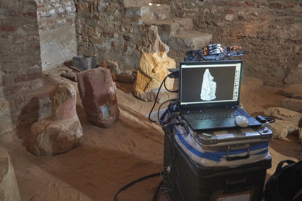
3D-Dokumentation von Statuen in den Royal Baths in Meroë, Sudan, mit Hilfe des Streiflichtscan-Verfahrens, das eine große Messgenauigkeit aufweist. © DAI // Simone Wolf
Standardisation
Digital research also plays an important role in analysing the data collected in the field and in the DAI's own laboratory. The data are structured in databases, processed in geo-information systems and modelled using computer-aided design. For this further processing, data and documentation must be standardised and described in the form of unique metadata.
The DAI has therefore established a research data management system based on the FAIR principles of findability, accessibility, interoperability and reusability to ensure the sustainable and systematic exploitation, use and preservation of our extensive research data. It also includes a modern publication strategy which provides open access to research data and makes full use of new digital formats.
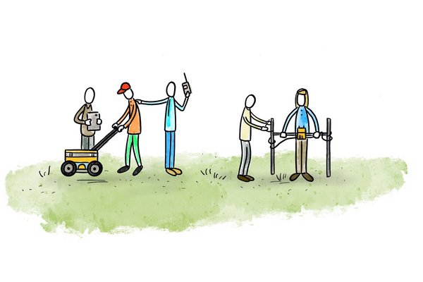
© DAI // Jens Notroff
These methods, the application of which is being further developed by the Department of Prospection and Excavation Methodology at the Roman-Germanic Commission of the DAI, make it possible to record and document important archaeological sites even without extensive excavation.
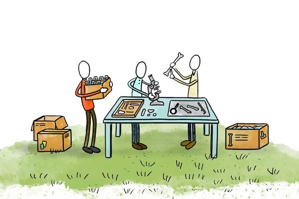
© DAI // Jens Notroff
Archaeobiological finds of bone, wood and other botanical remains are examined and identified both on site at the excavation sites and in the subsequent analysis of the finds by specialists, such as those represented in the Natural Sciences Department at the DAI Head Office.
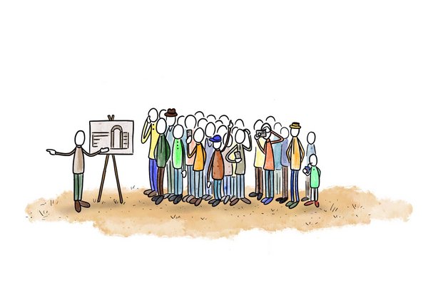
© DAI // Jens Notroff
The dissemination of this knowledge to society is based on the digital research data infrastructure developed at the DAI and a wide range of publication and educational formats.
