Neue Publikation im Journal of Global Archaeology (JoGA 2025)

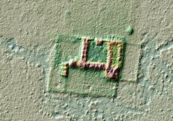
Our knowledge of the missions established by the Jesuits in the Llanos de Mojos in the late 17th and early 18th centuries has so far been based exclusively on written sources of the time. This article presents lidar plans of two of these missions. The amazing detail of the plans provides us hardly imagined insights into the structure of these missions. For both missions, a brief outline of their history is given first, as without this background it is impossible to determine which “version” of the respective mission the Lidar maps show. Here we can anticipate that one of the lidar maps shows the second foundation of the mission Santísima Trinidad, which existed between 1711 and 1769, and the other very probably depicts the mission San Martín, founded in the Iténez area around 1708, which was only moved to another location shortly before the Jesuits were expelled from the Americas in 1767.
The article can be downloaded here as a PDF or read in the Journal Viewer: https://doi.org/10.34780/3wzrdv46
Kontakt
Dr.
Christina Franken
, Referentin für Asien
Christina.Franken@dainst.de
DAI Pressestelle
Podbielskiallee 69
14195 Berlin
Tel.: +49 (0)30 187711-120
Mail: presse@dainst.de

